


|
The Fantozzi Company is dedicated to providing its services on a timely basis without sacrificing quality. We are committed to the highest standards of performance and state-ofthe art engineering technology. Perception and a keen sense for innovation give The Fantozzi Company the performance edge to turn ideas into real solutions ... on demand. The Fantozzi Company has built a track record of successful projects meeting schedules, meeting budgets, and performing above expectations. Our approach is simple: * Evaluate the
technical
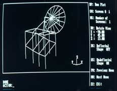
restraints To support this approach, The Fantozzi Company is committed to be on the leading edge of engineering technology. We have the resources to meet the challenge of a changing economic and technological environment. Experience has shown that a significant increase in productivity can be realized by using CAD. The key advantages are improved speed, accuracy and creativity. Design and detail libraries are maintained and recalled to produce drawings to meet the client requirements quickly. Revisions can be handled quickly and efficiently. This allows us the flexibility to meet changing criteria and last-minute changes. With our unique layering system, we have the ability to plan the drawing production to meet the needs of the project. Drawings can be segmented to satisfy both construction and postconstruction maintenance-documentation needs. A special feature of our system is its dynamic graphical relational database manager. The database manager works not only with text and numeric data, but also with graphics. There is a dynamic link between graphics and alpha-numeric information, so changes in one are automatically reflected in the other. All together, our system offers CAD and GIS (geographical information system). GIS can lead to new ways of thinking about and dealing with old problems.. Since it permits use of spatial relationships, a GIS adds a degree of intelligence and sophistication to a transportation or facility management database that has previously been unknown. Putting this knowledge to work, a GIS could compute and display a route for shipping hazardous materials with minimum population exposure. Or display the number of low-income persons living within two blocks of a bus stop. A GIS for a piping system may include pipe, valve and joint attribute information. GIS capabilities include facility information, maintenance scheduling and reporting, regulatory compliance, rightof-way tracking, custom map production, network analysis and environmental monitoring. GIS is becoming a powerful tool for enhancing competitiveness, customer service and responsiveness to regulatory requirements. GIS capabilities include facility information, maintenance scheduling and reporting, regulatory compliance, right-of-way tracking, custom map production, network analysis and environmental monitoring. The possibilities are unlimited. |
 |
[ Home | About Us | Projects | Services | Contact Us ]
